
The Technology Behind Location Tracking
Imagine you are standing in the middle of a busy city you have never visited before. You pull out your phone, open a map app, and within seconds a small blue dot appears, pinpointing your precise location. Not just only the city you are in but often the very street, building, or even side of the road where you are standing.
Pretty impressive for a device that fits in your pocket.
What is even more remarkable is that your phone can do this almost anywhere in the world—whether you are driving through a crowded city , hiking in a remote forest , trying out new restaurant, tracking morning jogs, or exploring a new country. It doesn’t need someone following you around with a map, and it certainly isn’t guessing.
So how does your phone always seem to know where you are?
The answer lies in an advanced network of satellites orbiting thousands of kilometers above Earth, constantly sending signal through space at the speed of light. Combined with powerful software, cellular networks, and Wi-Fi technology, these signals allow your phone to calculate your position in just a few seconds.
What feels like an effortless convenience is actually one of the greatest technological achievements of the modern era. Every time you request directions, order a ride, or share your location with a friend, a fascinating chain of events takes place behind the scenes.
Let us take a closer look at the technology that helps your phone find you almost anywhere on the planet.
The Basics of Location Tracking
At its core, location tracking is the process of determining the position of a device relative to the Earth.
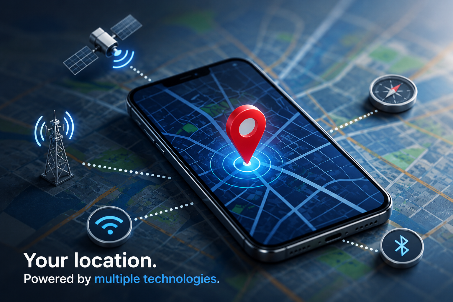
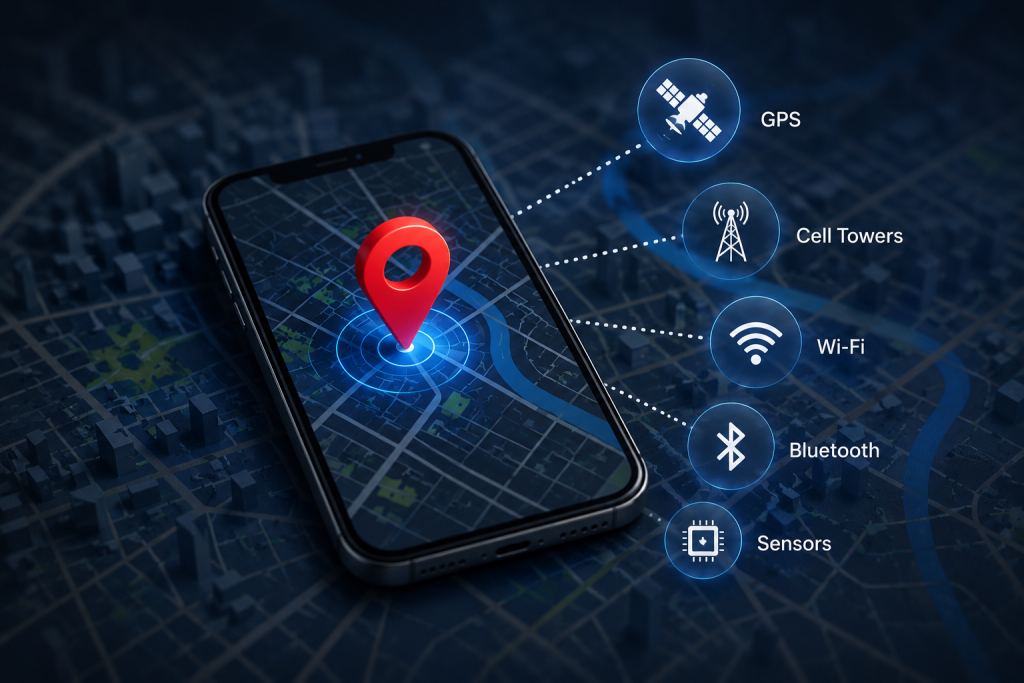
Your smartphone can identify it’s location using several technologies, including:
- GPS satellites
- Cellular towers
- Wi-Fi networks
- Bluetooth signals
While many people use the term GPS to describe all forms of location tracking, GPS is only one part of the process. Modern smartphones combine information from multiple sources to provide faster and more detailed location data.
The most essential of those technologies is GPS, or the Global Positioning System.
What is GPS?
GPS is an acronym for Global Positioning System. It is a satellite-based navigation system that allows devices anywhere on Earth to determine their position.
The system was originally developed for military purposes but eventually became available for civilian use. Today, billions of people around the world depend on GPS every day without even realizing it.
GPS consists of three main parts:
1. Satellites
A network of satellites revolves the Earth continuously
2. Ground Stations
Monitoring stations on Earth track the satellites and ensure they remain accurate.
3. GPS Receivers
Devices such as vehicles, smart watches, smartphones, and navigation systems receive signals from Satellites and calculate their locations.
Together, these components create a worldwide navigation system that operates 24 hours a day.
The Satellites Above Us
One of the most captivating aspects of GPS is the network of satellites orbiting thousands of kilometers above the Earth.
These satellites travel at incredible speeds while constantly transmitting signals toward the planet.
Each satellite continuously broadcasts:
- It’s current position
- The exact time the signal was sent
This information may seem simple, but it provides everything a GPS receiver needs to calculate its location.
The satellites are equipped with extremely precise atomic clocks. These clocks are so accurate that they lose only tiny fractions of a second over many years.
This level of precision is important because even a small timing error could result in major location inaccuracies.
How Your Phone Receives GPS Signals
Your smartphone contains a tiny GPS receiver.
This receiver listens for signals from multiple satellites at the same time.
When a satellite sends signal, it travels through space at the speed of light. The phone records the moment it receives the signal and compares that time with the timestamp sent by the satellite.
By calculating how long the signal took to arrive, the phone can estimate the distance between itself and the satellite. This happens quickly and continuously while location services are active.
Why One Satellite Is Not Enough
Imagine a satellite tells your smartphone that it is 20,000 kilometers away.
Although this sounds useful, it doesn’t tell your phone exactly where it is. Knowing the distance from one satellite only tells the device that it could be located anywhere along huge sphere surrounding that satellite
The phone needs more information
When a second satellite is added, the possible location becomes much smaller because the two distance measurements intersect.
Adding a third satellite narrows the possibilities even further.
Finally, signals from four or more satellite allows the phone to determine its particular location.
This process is known as trilateration.
Understanding Trilateration
Trilateration is the mathematical methods used by GPS to determine the exact location.
Here is a simplified example:
Suppose your phone knows:
- It is 20,000 km from Satellite A
- It is 22,000 km from Satellite B
- It is 18,000 km from Satellite C
The phone uses these distance to identify the point where all three measurements overlap.
The overlap represents your location.
In reality, GPS calculations are much more complex, but the basic principle remains the same.
The phone continuously performs these calculations in the background to update your location in real time.
Why GPS Is So Accurate
Modern GPS technology can often determine location within just a few meters
Several factors contribute to this remarkable accuracy.
Atomic Clocks
Timing is everything to GPS. Because signals travel at the speed of light, even a tiny wrong timing can create major location errors.
Atomic clocks help ensure extraordinary precision.
Multiple Satellites
Modern smartphones often receive signals from many satellites simultaneously. The more satellite available, the more accurate the location estimate becomes.
Advanced Algorithms
Smartphones use refined software to correct errors and improve positioning.
Additional Location Sources
GPS is often combined with cellular and Wi-Fi data to improve performance.
The Role of Cellular Towers
GPS works extremely well outdoors, but it can sometimes be slow when you first activate location services. To speed things up, smartphones alse use cellular towers. Your phone constantly communicates with nearby towers.
By identifying which towers are nearby and measuring signal strength, the device can estimate its approximate location.
This method is not as consistent as GPS, but it helps the phone quickly determine the general area where it is located. Once GPS Signals become available, the phone refines the location estimate.
How Wi-Fi Helps Discover Your Location
Many people are surprised to learn that Wi-Fi networks can also help identify location.
Companies maintain massive database of Wi-Fi access points and their location. When your detects nearby Wi-Fi networks, it compares them with these database. If several known networks are nearby, the phone can assess where it is located.
This approach is especially useful indoors, where GPS signal may be weak. As a result, your phone can often find your location inside shopping malls, airports, office buildings, and other indoor environments.
Why Your Location Sometimes Is Not Accurate
Although location services highly reliable, they are not perfect.
Several factors can affect accuracy.
Tall Building
In large cities, signals may bounce off buildings before reaching your phone. This effect, known as multipath interference, can create errors.
Indoor Locations
Walls, ceiling, and other structures weaken GPS signals.
Tunnels
GPS signals usually cannot penetrate underground spaces.
Weather Conditions
Severe atmospheric conditions can sometimes affect signal quality.
Obstructions
Mountains, dense forests, and other obstacles may block satellite signals.
These challenges explain why your location occasionally appears slightly off on a map.
How Maps Use Your Location
Knowing where you are is only part of the process.
Navigation apps combine location data with digital maps to provide useful services.
For example, a navigation app can:
- Show your current position
- Calculate routes
- Estimate travel times
- Provide turn-by-turn directions
- Suggest nearby businesses
Without accurate location data, these services would not be possible.
Everyday Applications of Location Technology
Location services have become deeply integrated into modern life.
Navigation
This is the most obvious use of maps. Millions of people rely on location tracking to connect drivers and passengers.
Food Delivery
Delivery services depend on accurate positioning to ensure orders reach customers.
Fitness Tracking
Running and cycling apps use location data to measure distance coverage and performance.
Emergency Services
Emergency responders can use location information to reach people more quickly.
Weather Services
Weather apps often use your location to provide local forecasts.
Social Media
Many social media platforms allow users to tag locations in posts and photos.
Privacy and Location Tracking
While location services provide convenience, they also raise important privacy questions.
Your location can reveal a great deal about your daily activities, including:
- Where you live
- Where you work
- Places you visit
- Travel habits
Because of this, smartphone operating systems allow users to control location permissions.
Many apps now require permission before accessing location data.
Users can typically choose between:
- Always allow
- Allow while using the app
- Do not allow
Reviewing these permissions regularly can help protect personal privacy.
The Future of Location Technology
Location Technology continues to evolve.
Future improvements may include:
Greater Accuracy
Emerging systems could provide location measurements within centimeters rather than meters.
Better Indoor Navigation
New technologies are making indoor positioning more reliable.
Augmented Reality
Future navigation systems may overly directions directly onto the real world through smart glasses and phone cameras.
Smarter Transportation
Self-driving vehicles depend heavily on accurate location information.
Expanded Satellite Networks
Additional satellite systems are helping improve global coverage and reliability.
As these technologies develop, location services will become more useful and powerful.
Conclusion
The next time you open a map and see your location appear instantly, remember the incredible technology working under the hood. Your phone communicates with satellites thousands of kilometers above the Earth, analyzes signals traveling at the speed of light, consults cellular towers and Wi-Fi networks, and performs complex mathematics calculations —all within seconds.
What feels like a simple feature is actually the result of decades of scientific innovation and engineering excellence. GPS and modern location services have transformed navigation, transportation, communication, and other aspects of daily life.
From helping people find their way to enabling entire industries, location Technology has become one of the most important tools of a digital age. And as technology continues to improve, the way our devices understand where we are will only become faster, smarter, and more accurate.